Years of excellence
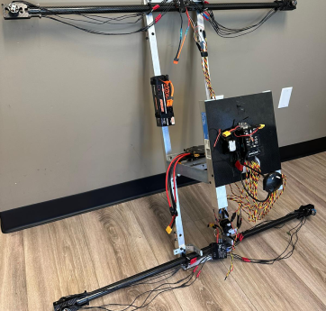
Airframe + Sensors + Compute + Communication + Control.
Neural Networks, Computer Vision, Sensors fusion, path planning running on the drone.
Multi-UAV Coordination, Collision Avoidance, Task Allocation
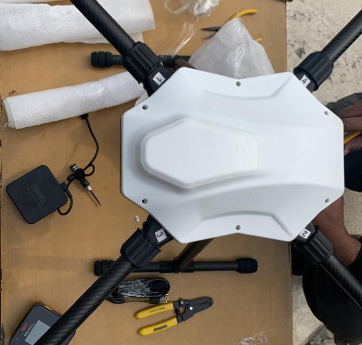
Lidar, Multispectral imagers, Thermal, LiDAR, Light measurement modules, RF sensors, etc
Pilot Training, Maintenance, Remote Troubleshooting, Insurance Support.
AI drones for real-time monitoring, mapping and situational awareness.
We plan, deploy, and deliver precision drone solutions tailored to your operational needs, ensuring accuracy, safety, and reliable results every time.
Start a ProjectSubmit your requirements and goals so we can design the right drone solution for you.
Our experts plan and schedule a mission that fits your timeline and site conditions.
We deploy advanced UAVs to deliver accurate data and measurable outcomes fast.
Successfully delivered advanced drone-based solutions across surveillance, inspection, and aerial mapping projects for commercial and industrial clients, ensuring accuracy, safety, and operational efficiency.
Executed customized UAV missions using high-performance platforms and expert flight teams, providing reliable aerial data, real-time monitoring, and actionable insights across diverse environments.
"The image quality is stunning, and the drone is so easy to fly. Perfect for my real estate photography business!
CEO at AgroTech
"The image quality is stunning, and the drone is so easy to fly. Perfect for my real estate photography business!
General Manager at NanTech
Submit your requirements and goals so we can design the right drone solution for you.